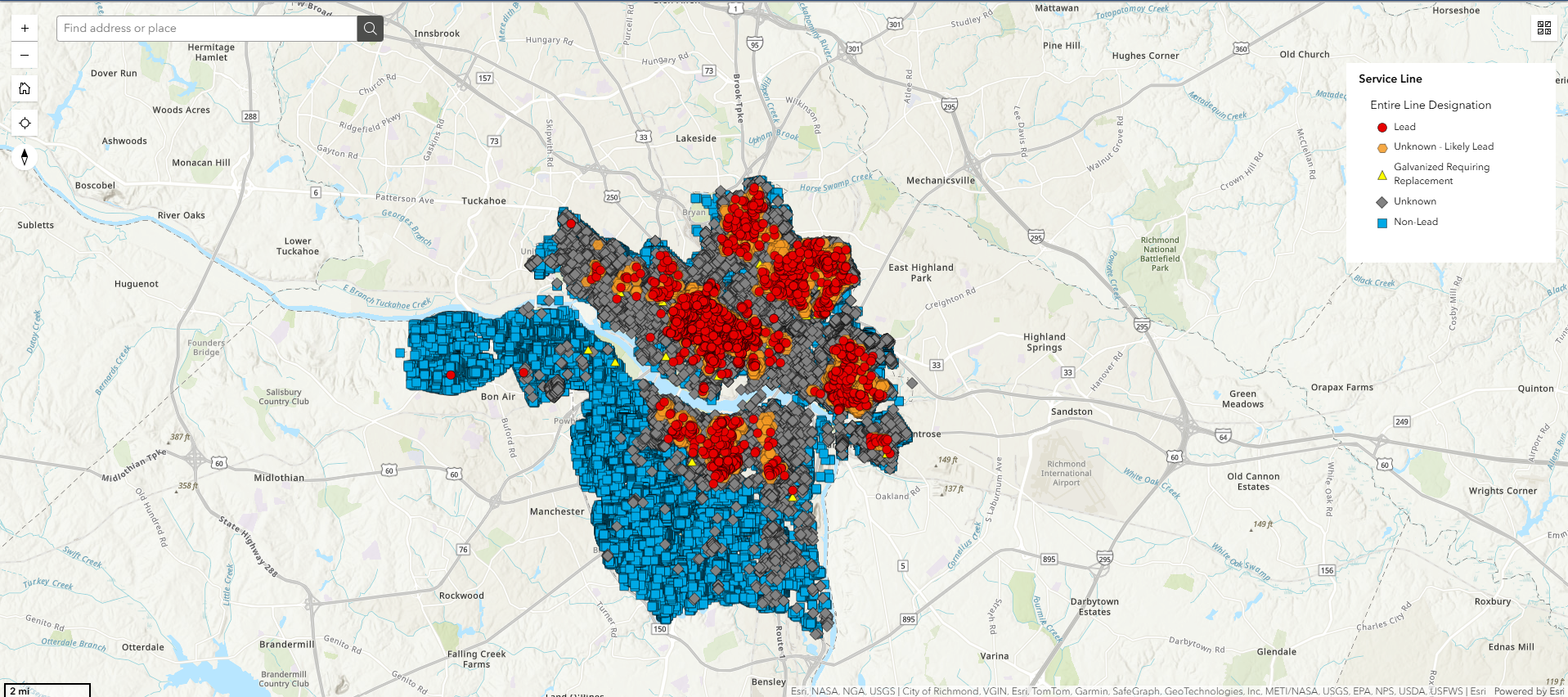
Click here to view the map that identifies the material of water service lines.
Click here to start the survey.
Click here for survey instructions.
Click here if you need plumber assistance.
Combined Sewer Overflow
A Combined Sewer Overflow (CSO) is a discharge of untreated storm and wastewater from a combined sewer into the environment. During dry weather, combined sewer systems carry all the sanitary flow to wastewater treatment plants. During times of rainfall, however, the amount of rainfall adds to the amount of flow going to the treatment plant. This heavier flow is greater than the capacity of the combined sewer system. When the flow exceeds, the capacity, the excess flow is discharged directly to the river at various overflow points in the sewer system. In Richmond, the major overflow points are found on the banks of the James River and Gillies Creek.
Learn more about the DPU’s efforts to manage the City’s combined sewer overflows.
CSO Outfalls
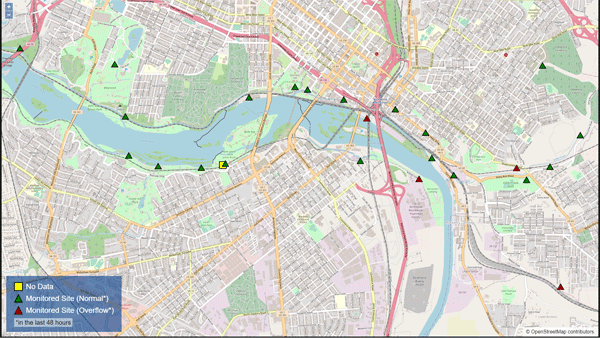
There are 25 CSO outfalls located at various points along the James River within the city's CSO area.
Interactive map of the outfalls.*

Richmond has posted signs at every outfall, alerting people to the presence of CSOs and warning against swimming during and after rain events. A contact phone number is provided for additional information
Ideally, separate pipes will capture the two types of flow (sewer and stormwater) but the cost would be enormous. Extensive excavation of the city streets to duplicate the piping would be necessary, and this still would not solve the problem of chemicals and other debris that enter our waterways through stormwater pipes and drains.
CSO Outfall Reports
These reports reflect results from new monitoring technology, using sensors and meters in the combined sewer system.
2025 Reports
2024 Reports
2023 Reports
September 2023
December 2023
2022 Reports
* CSO overflow email notifications are no longer provided, as the interactive map provides that data.


